Sunday, 7 September 2008

PPL Ex 18 (xiv): Navigation Planning: Example: EGBD - EGTK - EGBD (Part 1: CBVRP - LICVRP - BITTESWELL VRP)


The Plan is a flight from EGBD to Oxford Kidlington EGTK via CHURCH BROUGHTON VRP, LICHFIELD VRP and BITTESWELL VRP. Land at Oxford for lunch. Then depart Oxford and fly via CHARLBURY VRP, COSFORD AERODROME & CHURCH BROUGHTON VRP to EGBD.
(Click on any image to ENLARGE.) The first image is an OVERVIEW of the planned route. Note: No Winds have been applied in these examples. The assumption is that we are always 'on track'. See other Navigation Exercises for explanations & examples of TAS/HDG/VAR/DEV/GS/MAX DRIFT/TWC/HWC/XWC/HA/1:60 rule etc.

The first leg is to CBVRP - this is a variable depending on the runway in use. The second leg is CBVRP - LICVRP which is 197-deg (T)/10.5nm. Having zeroed the CHRONO over CBVRP continue the en route climb to 2,600ft AMSL (QNH) and advise Derby Radio: "G-BJXZ overhead Church Broughton departing the circuit to the southwest and changing to Tatenhill Radio 124.075." Make contact with Tatenhill Radio: "Tatenhill Radio G-BJXZ." "G-XZ pass your message." "G-XZ a Cessna 172 from Derby to Oxford via Church Broughton & LICVRP. Position 2nm SW CBVRP at 2400ft climbing to 2600ft. Overflying your ATZ. Request traffic information" If the radio is manned, Tatenhill will acknowledge your call & give you the QFE, the RW in use and information about any known traffic. When clear of Tatenhill ATZ advise Tatenhill Radio that you are changing to Birmingham Approach. Contact Birmingham Approach on frequency 118.050: "Birmingham Approach G-BJXZ request Flight Information Service." "G-BJXZ pass your message." "G-BJXZ Cessna 172 from Derby to Oxford via LICVRP & Bitteswell VRP. 2nm NE LICVRP at 2600ft. Request Flight Information Service." Birmingham will acknowledge your radio call and give you the Birmingham QNH. You may also be asked to Sqwark a code other than 7000. You may also be asked for an ETA at Bitteswell.
Keep a good lookout. Fly your HDG (heading) accurately and keep good CHRONO discipline. As you approach LICVRP do the FREDA checks. Note 1: The 1501ft AMSL mast just to the left of the extended track. The MEF  (Maximum Elevation Figure) here is 1.6 (thousand feet) so we are safe at 2,600ft on Birmingham QNH. Note 2: The proximity of Birmingham CTA on the right of track and East Midlands CTA on the left.

Note the GVS just north of LICVRP. Over LICVRP turn onto the next HDG and make sure that the CHRONO is running. The Track(T) is 127-degrees and the Distance to Bitteswell VRP is 25nm.

The ground features to look for on this leg are (in order): The lake just NE of Tamworth town. The M42 Motorway just after 1/4 leg distance. Nuneaton VRP just after 1/2 distance. Hinckley town and Railway Line at 3/4 distance then M69 Motorway. Then Bitteswell VRP. Note 3: Birmingham may ask you to contact Coventry Approach on 119.250 because you will be flying through the extended ILS (Instrument Landing System) approach. It is probably prudent to call Coventry Approach anyway!

Go To Part 2 ..............

Thursday, 4 September 2008

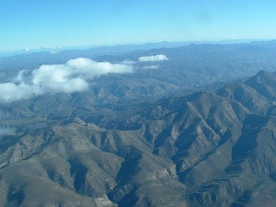
Your Flight Planning Has Been Done - Now enjoy the VIEW: A friend in Johannesburg - from way back.

Weather & NOTAMs? CHECKED.
Flight planning? COMPLETED.

Weight & Balance? CALCULATED.
ATC? NOTIFIED.
Aircraft? CHECKED.

Fuel & Oil? CHECKED A/R.
Passengers? BRIEFED.

OK - Let's GO!


PPL Ex 18 (xiii): NAVIGATION: (OFF-TRACK CORRECTION)

(St Mawgan to Chivenor. Off track by 4nm. See Example below.)
Click on the image to ENLARGE.

1:60 Rule:
1nm Distance Off Track after 60nm Distance Flown = 1˚ HE*
2nm Distance Off Track after 60nm Distance Flown = 2˚ HE
10nm Distance Off Track after 60nm Distance Flown = 10˚ HE
10nm Distance Off track after 30nm Distance Flown = 20˚ HE
*HE = Heading Error
Basically, (60/Distance Flown) X Distance Off Track = Heading Error OR

(60/D1) X d1 = HE1˚

(Note 1: D1 = Distance Flown. d1 = Distance OFF. HE˚ = Heading Error and D = Total Leg Distance)

Now we know what the HEADING ERROR is to THIS POINT down track i.e. at D1.
If we turned by the amount of HEADING ERROR (in the correct direction of course) we would parallel the track. This would not help us to successfully fly to the next Turning Point or Destination. We would merely fly by the turning point by the distance off d1.
So we DON’T DO THAT. What we DO is:
Make a mental note of the HEADING ERROR (HE1˚)
Keep a mental note of the DISTANCE OFF (d1)
Calculate the distance to the next turning point D2 (D – D1)
Now we have all the information we need to calculate the HEADING ALTERATION to reach the next turning point
The calculation method is EXACTLY the same as the first one:

(60/D2) X d1 = HE2˚
Finally, ADD HE1˚+ HE2˚= HA˚ (Heading Alteration)


Example: Illustrated on the chart above.
Flight from St Mawgan to Chivenor.

Distance = 50nm.
At 30nm you estimate that the aircraft is 4nm right of track*.
There is 20nm to to go.
*This is much easier than drawing 'DRIFT' lines on all the flight plan legs.
To recapitulate:
[(60/D1) X d1] + [(60/D2) X d1] = HA
[(60/30) x 4] + [(60/20) x 4] = 20

HA = 20-degrees. Alter HEADING 20-degrees to the left.

These calculations can be done on the "Dalton" flight computer. d1 on outer scale against D1 on inner scale. Read H.E. aginst the INDEX (60).

TIP: If you fly an accurate HEADING by LOOKING OUT and maintain CHRONO discipline, then you should not have to calculate a heading alteration very often. You WILL be very close to your intended track.

Monday, 1 September 2008

PPL Ex 18 (xii): NAVIGATION (Headwind Component HWC & Tailwind Component TWC)


Click on an image to ENLARGE.

(Note: The chart is ORIENTATED in the direction of flight. Carsington Water is ahead & left.)


The Cross Wind (X-W) and X-wind Component (XWC) issues have been addressed, now we need to look at the Head Wind Component (HWC) & Tail Wind Component (TWC).

It has already been stated that, for practical purposes, the HWC can be considered as:

0˚ & 10˚, 20˚ & 30˚, 40˚, 50˚, 60˚, 70˚, 80˚ and 90˚ OFF the Required Track, where:

  • 0˚ & 10˚ = 100%
  • 20˚ & 30˚ = 90%
  • 40˚ = 80%
  • 50˚ = 60%
  • 60˚ = 50%
  • 70˚ = 30%
  • 80˚ = 20
  • 90˚ = 0%.

A 25kt wind from dead ahead or from 10˚ OFF will be 25kts of HWC. So:

  • From 0˚ or 10˚ OFF the HWC will be 25kts
  • From 20˚ or 30˚ OFF the HWC will be 22kts
  • From 40˚ OFF will be 20kts
  • From 50˚ OFF will be 15kts
  • From 60˚ OFF will be 12kts
  • From 70˚ OFF will be 8kts
  • From 80˚ OFF will be 5kts
  • From 90˚ OFF will be 0kts
  • From 100˚ OFF will be 5kts TWC
  • From 110˚ OFF will be 8kts TWC
    Etc……………

Apply the HWC or TWC to the TAS and you will have the GROUNDSPEED (GS).

Note: These calculations are not meant to replace flight planning. The idea is to facilitate quick and reasonably accurate mental reckoning in flight.

PPL Ex 18 (xi): NAVIGATION: (GOOD PRACTICE - POINTERS


(Click on an image to ENLARGE! )

Use the 'BIG' features en route.


  • Blithfield reservoir is a good feature to look ahead for , and is very distinctive.


In Flight:

Having planned your flight accurately with the best information available, http://www.metoffice.co.uk/ and having checked the NOTAMS at
http://www.ais.org.uk/ you are now ready to fly the flight.

From my experience here are some GOOD PRACTICE points:

  • Remember your CHRONO discipline
  • Orientate your chart to the direction of your TRACK
  • Learn the meaning of the Chart Symbols
    It is not practical to unfold your chart in flight in order to check a legend symbol
    See a previous AEROfile entry re cutting & pasting the LEGEND into an A5 ClearView folder
  • Fly the calculated Compass Heading as accurately as possible – HEADING discipline
    Use the Direction Indicator to turn onto the required heading, THEN use an aiming point near the horizon
  • Same principle with ALTITUDE – use the VISUAL HORIZON. Ex 6 Straight & Level Flight
    LOOKOUT – ATTITUDE - INSTRUMENTS
  • Resynchronise the DI with the Compass at least every 15 minutes
  • Keep a very good LOOKOUT for other aircraft
  • Identify the ‘Big Features’ en route
    E.g. Reservoirs, Lakes, Dams, Cities, VRPs etc. on or either side of the track
    Rivers, Canals, Railway Lines, Motorways etc; which cross your track
  • Lookout for Aerials, Masts, High Ground which you will also have identified during the flight planning stage
  • Read from the Ground to the Chart
  • Keep aware of the terrain and obstacles close to your planned route
  • Always know what the MAXIMUM ELEVATION FIGURE (MEF) is and add a safe increment to it.
    NB: The MEF is NOT a safety altitude
  • Keep the SITUATION AWARENESS mode going
    Danger Areas, Restricted Areas, AIAAs, CTRs, CTZs, ATZs, Gliding Sites etc
    Gross Error Checks: Does It Look Right?
  • Try to assess what the W/V is actually doing with regards to HEADING and GROUNDSPEED
    If the clouds are FEW or SCATTERED (FEW or SCT) and the sun is shining, you may be able to assess the wind direction and speed from the cloud shadows!
  • Use [(60/D1) X d1] + [(60/D2) X d1] = HA as described in Navigation 18 (xiii) above. WHY? Because it is easier to estimate distance off than angle off.
  • Beware: Do not mistake large areas of plastic sheeting, or greenhouses, for water features. At a distance, light reflection can be very deceptive!
  • Always think ahead of the aircraft
  • Anticipate the radio calls to the ATSUs that you have to contact
    The frequencies are printed on the chart
    See R/T Phraseology previous AEROfile entry
  • Get weather reports as required en route
    If the weather deteriorates to less than your required minima:
    Divert, or turn back
    Ask for assistance

    Navigation is a big subject. Do not just rely on the GPS. Use a GPS wisely AND also apply the principles of Pilot Navigation as discussed here in AEROfile and from your PPL Navigation Manual.

PA-22 Piper Tri Pacer


Doesn't looking at this aeroplane just make you want to fly?